Cumbemayo or Cumbe Mayo is an archaeological site located 20 kilometers (12
mi) southwest of the city of Cajamarca in Peru at 3,500 meters (11,483 ft) of
elevation.
Built around 1500 BCE, it comprises aqueducts, a grotto and petroglyphs; all
within an area of rock formations.
|
Cumbemayo map
Location of the Archaeological Complex of Cumbemayo.
-
Above, we can see the location of Cumbemayo in the province of
Cajamarca.
-
Below, we can see the boundaries of the Archaeological Complex of
Cumbemayo.
|
|
Plan of Cumbemayo
Plan Legend:
- Entrance
- Steep descent
- First altar and first grotto
- Fork in the path
- Second cave
- Viewpoint
- Volcanic pillars
- Indigenous womans
- Main plaza
- Bridge
- Third cave
- Exit
|
|
The route begins with a very steep descent (Plan No. 2)
|
|
Then we have to go up
We are in front of the friars of Cumbemayo, where the ritual process of
the canals begins.
- This is where the first altar is located.
|
|
The first altar (Plan No. 3)
The first altar on the friars' slopes with figures from a hirophany that
was the predecessor of the Chavín culture.
|
|
The first grotto, the Sanctuary
It is argued that this grotto is a place of worship, due to the presence
of its petroglyphs, its orientation to the Sun and its location in the
complex.
-
The base is almost perfectly circular, 3.10 x 3.30 m (10.17 ft x 10.82
ft) with a height of 2.75 m (9.02 ft).
-
Although the name is not correct, it would be associated with the
beginning of the rite, at the time when the shadow was projected in
the middle of the grotto, in a quadrangular niche, in the center of
which the wear of the stone is recorded by the runoff of the water
that filters from the top of the hill and runs depositing in five
holes, four of which remind us of the Southern Cross.
|
|
The first grotto, the Sanctuary
There are other ritual holes, four of them imitating the Southern Cross,
whose left arm coincides with the centre of the niche.
-
An entrance barrier 0.20 m (0.65 ft) high shows figures on both sides,
as well as the floor and walls of the interior.
-
Crosses, faces, the three staircases, plants, animals (snakes), human
figures in motion, others unrecognisable, cover the entire cave.
|
|
Continuing up until the fork in the path (Plan No. 4)
At this fork in the path, we can take the left path and go over the
cliff, or we can take the right path and go around the cliff.
|
|
Preparing to cross the cliff
Those who turned left at the fork in the path will cross the cliff
through a very narrow passage. The others, who took the path to the
right, will go around the cliff.
|
|
Emerging from the other side of the cliff
Those who crossed the cliff emerge on the other side of the cliff.
|
|
Going up towards the viewpoint
|
|
Panorama of the path leading to the viewpoint
|
|
Another panorama of the path leading to the viewpoint
On the right side of the panorama is the second cave (Plan No. 5).
-
The second cave or “Lesser Sanctuary” is located 300 m (984 ft) west
of the previous one, at 3,592 meters (11,785 ft) of altitude at 7° 11'
19.8" S, 78° 34' 33.3" W.
-
It would seem that due to its location characteristics, dimensions,
such as the current state of the figures, and because it is close and
associated with a steep path, 0.40 m x 5 m (1,3 ft x 16 ft) wide,
built on the stone that crosses the open, at 3620 meters (11,877 ft)
of height (7° 11' 27.1" S, 78° 34' 57.4" W) and with fine ritual
activity, it is prior to the sanctuary.
-
At the entrance, at the mouth, is a monolith with figures distinct
from the previous ones, quite eroded and simpler. From there come
channels that repeat the drain tray when it rains.
|
|
The viewpoint (Plan No. 6)
When we arrive at the viewpoint we take a well-deserved rest.
|
|
Panorama of the east side of Cumbemayo from the viewpoint
|
|
Panorama of the west side of Cumbemayo from the viewpoint
After climbing the eastern half of Cumbemayo, we will now descend the
western half of Cumbemayo.
|
|
Panorama of the west side of Cumbemayo
|
|
Panorama of Los Frailones (Plan No. 7)
Los Frailones are massive volcanic pillars, some stretching as high as
18 metres (60 feet).
-
The stone forests suddenly appear from the landscape, starkly
contrasting the flat, grass-covered plains around Cajamarca. The
erosive forces of wind and rain likely carved out the pillars.
-
Many of the pillars, carved by wind and rain have taken on new shapes,
resembling hands and even animals, and allowing the mind to wander in
the pristine Peruvian setting.
-
Their impressive and rare geological formations, where some will
identify the shapes of monks forming part of procession (hence the
name frailones, Spanish for friars).
|
|
Descending between the volcanic pillars
|
|
Indigenous woman selling her handicrafts (Plan No. 8)
At the end of the descent, an indigenous woman, accompanied by her
horse, sells her handicrafts.
|
|
Another indigenous woman selling her handicrafts
A little further on, another indigenous woman, in the company of her
daughter, sells her handicrafts.
|
|
The Main plaza (Plan No. 9)
The main plaza is the religious hydraulic complex par excellence.
-
It begins in a large square that rests on a platform where the channel
coming from the intake in the divortium acuarium meets another
smaller stone channel, in what is known as the inlet intake, with a
stone with horizontal marks that recalls the graduated sight that
measures the inlet flow.
-
Here we can see three blocks, like steps, in which the first figures
have been carved, and which constitute the so-called altar or pulpit.
-
Five metres (16 ft) away, there is a platform measuring 1.80 m x 2.6 m
(6 x 8.5 ft), on the surface of which we find, associated with a
double chain of small holes, two pairs of sandal soles. The first
pair, measuring 11 x 23 cm (4.3 x 9 in), begins the path to the north,
and the second, measuring 9.5 x 22 cm (3.7 x 8.7 in), returns in a
southerly direction. The guides attribute these figures to supposed
marriages that took place there.
-
Nearby there is a circular rock with very eroded figures, highlighting
the spiral, on the banks of the canal. The upper part or face is flat
and has figures that due to the nature of the stone are almost erased.
Its presence would speak of movement, energy, tracking, driving, life,
etc. This symbol is repeated in all cultures and is described as the
snake, the cosmos. In the Nasca culture, it is found on the tail of El
Mono.
|
|
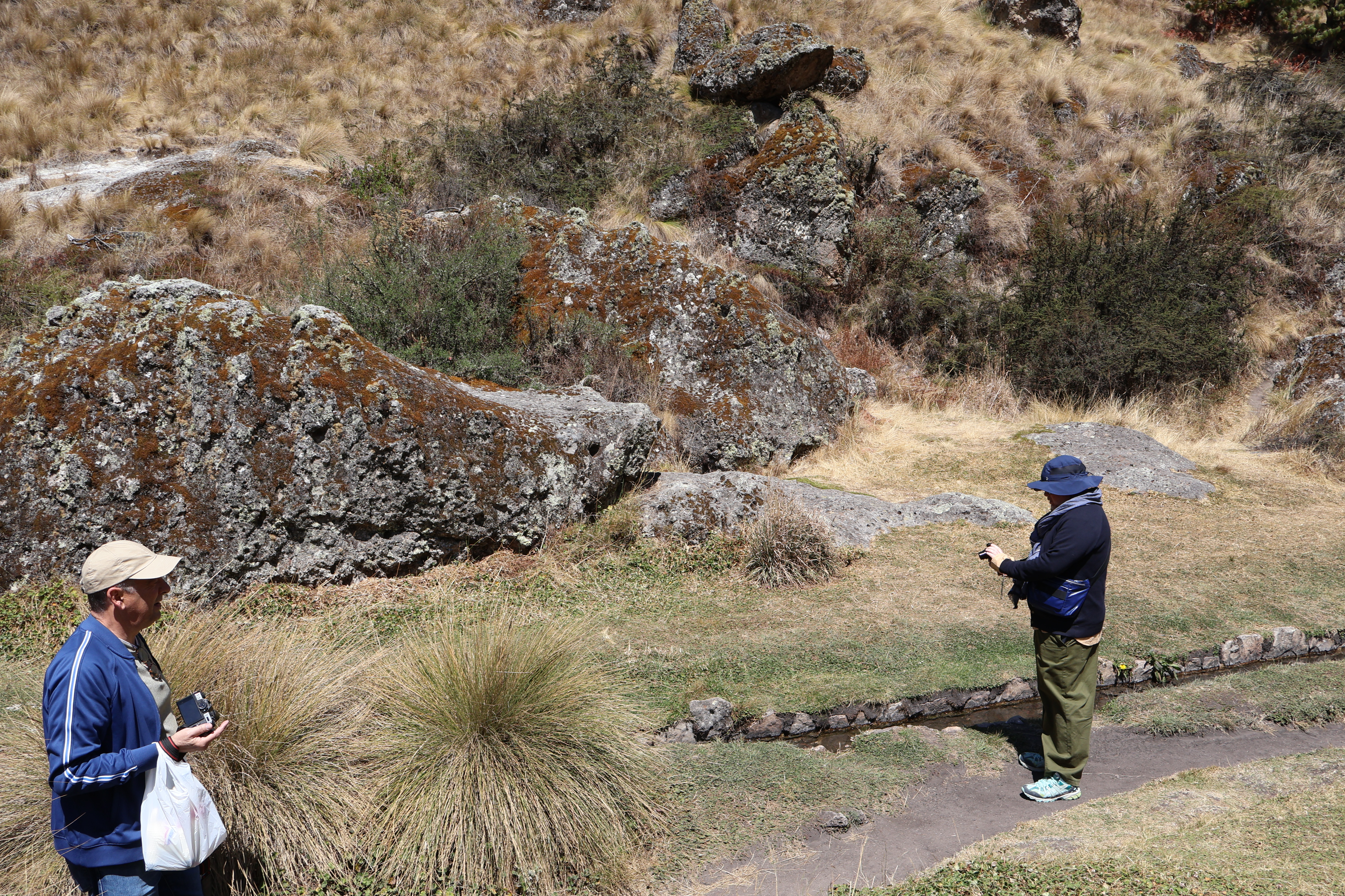
Bridge on the water channel (Plan No. 10)
One of the main attractions of Cumbemayo, or "Narrow River" in Cajamarca
Quechua, is the aqueduct.
-
This is a canal of approximately 9 km (5.6 mi) in length, carefully
carved in volcanic rock to divert the water from the hills to
cultivation fields and a large reservoir; which is presumably
originally at the foot of the Santa Apolonia Hill.
|
|
Panorama of the Bridge (left) and the Main plaza (right)
|
|
Walking along the water channel heading east
Some Chavín-type features stand out along the route, which is why it is
associated with this culture, which is possible, but influencing or
contributing to its formation.
-
Beginning of segment II of the channel or projection. It retains
similar characteristics with segment I in its layout and the
petroglyphs are more defined, such as the Andean cross.
|
|
Stopping to appreciate some figures
All the figures are related to the canal; their location is not
explained in any other way, to express ideas associated with the path of
the water.
-
The figures are found isolated, separated by a certain distance, or in
murals, limited by the size of the stone, but constituting a whole. It
is worth highlighting the presence of the square cross, from which the
chacana evolves. This symbol is the basis of the strokes in the
channel. You can also see faces or parts of the body, such as hands,
feet, raised arms, faces, eyes, spirals, steps, grooves, holes.
-
The presence of the Southern Cross is important, linked to the rains,
its presence has not ceased to be valid. Many customs and traditions
of Cajamarca are associated with the crosses: religious festivals,
placed on the roofs for protection, etc.
-
Associated with the crosses is a petroglyph in the form of a
four-sided star, with a glow with four lines on each side. The most
resplendent “star” in the firmament is, without a doubt, Venus.
|
|
Figure of the shining star (Venus?)
|
|
Continuing to walk along the water channel
|
|
Christian crosses
-
Segment II of the canal continues on artificial foundations (fills)
and excavation in the rock.
|
|
Square mouth entrance to the tunnel
Aqueduct and square mouth entrance to the tunnel that runs ten meters
through the side of the hill.
|
|
Exit from the tunnel
Exit from the rectangular mouth, from the tunnel.
- With 80 x 60 cm (31.5 x 23.6 in) high.
|
|
Zigzag cut
Zigzag cut of the hillside with a mural of petroglyphs.
-
By narrowing or widening the channel in some sections, they reduced
the speed and dissipated energy through expansion effects.
-
They also built zigzags in the first segment, and sometimes placed
obstacles (usually large stone blocks) on the banks of the channel,
for the same purpose.
|
|
The third cave (plan No. 11)
The third cave is located in Segment II of the canal, at the base of the
front there are petroglyphs.
-
The third cave seems to belong to the next extension of the canal,
taking advantage of a natural cave at 3,553 meters (11,656 ft) of
altitude (7° 11' 31.6" S, 78° 34' 35.7" W). It is located on one side
of the route, next to a small aqueduct of the canal that extends
through the living rock and in whose interior two life-size hands and
small feet can be seen.
-
The entrance is facilitated by a step carved from the bottom to the
mouth of the cave. Its figures are more recognizable, standing out the
symbol of the three steps accompanied by the square cross.
|
|
Stone with hieratic figures at the entrance to the third cave
|
|
The last stretch of the water channel
Walking along the last stretch of the water channel.
-
From the third cave point on, isolated figures are recorded on the
stone walls of the canal every certain stretch, such as faces, arms
bent at a right angle showing the palm of the hand, faces facing
forward and above all square crosses without association to other
figures.
-
At the end, a three-meter-long mural is visible, like a ribbon of
unmistakable conceptual inscription. The canal then deepens into the
land via Layzón.
|
|
Leaving Cumbemayo (Plan No. 12)
|
See also
Source
Location