Kabah (also spelled Kabaah, Kabáh, Kahbah and Kaba) is a Maya archaeological
site in the Puuc region of western Yucatan, south of Mérida.
Kabah is south of Uxmal, connected to that site by an 18 km (11 mi) long
raised causeway 5 m (16 ft) wide with monumental arches at each end. Kabah is
the second largest ruin of the Puuc region after Uxmal.
The site is on Fed. 261, approximately 140 km (87 mi) south from Mérida,
Yucatán, towards Campeche, and is a popular tourism destination. Ruins extend
for a considerable distance on both sides of the highway; many of the more
distant structures are little visited, and some are still overgrown with
forest.
|
Entering Kabah.
Visit of the East Group, starting with the Lower Square.
|
|
Kabah map.
The city is shaped around an axis, which goes from north to south and
its buildings are connected by causeways, or sacbés.
-
One of these larger roads is the one that leaves through the Triumphal
Arch and reaches Uxmal, which is about 17 km (11 mi) to the northwest.
-
The buildings are grouped into separate sets of buildings, located one
to the east and the other to the west of the main north-south axis.
|
|
Ceiba tree in the Lower Square.
Ceiba pentandra is a tropical tree of the order Malvales and the
family Malvaceae (previously emplaced in the family Bombacaceae), native
to Mexico, Central America and the Caribbean, northern South America.
The tree and the cotton-like fluff obtained from its seed pods are
commonly known in English as "kapok". In Spanish-speaking countries the
tree is commonly known as "ceiba" and in French-speaking countries as
"fromager".
-
The trunk and many of the larger branches are often crowded with large
simple thorns.
-
The ceiba was the most sacred tree for the ancient Maya, and according
to Maya mythology, it was the symbol of the universe. The tree
signified a route of communication between the three levels of earth.
Its roots were said to reach down into the underworld, its trunk
represented the middle world where the humans live, and its canopy of
branches arched high in the sky symbolized the upper world and the
thirteen levels in which the Maya heaven was divided.
-
According to the Maya, the world is a quincunx, consisting of four
directional quadrants and a central space corresponding to the fifth
direction. Colors associated with the quincunx are red in the east,
white in the north, black in the west, yellow in the south, and green
in the center.
|
|
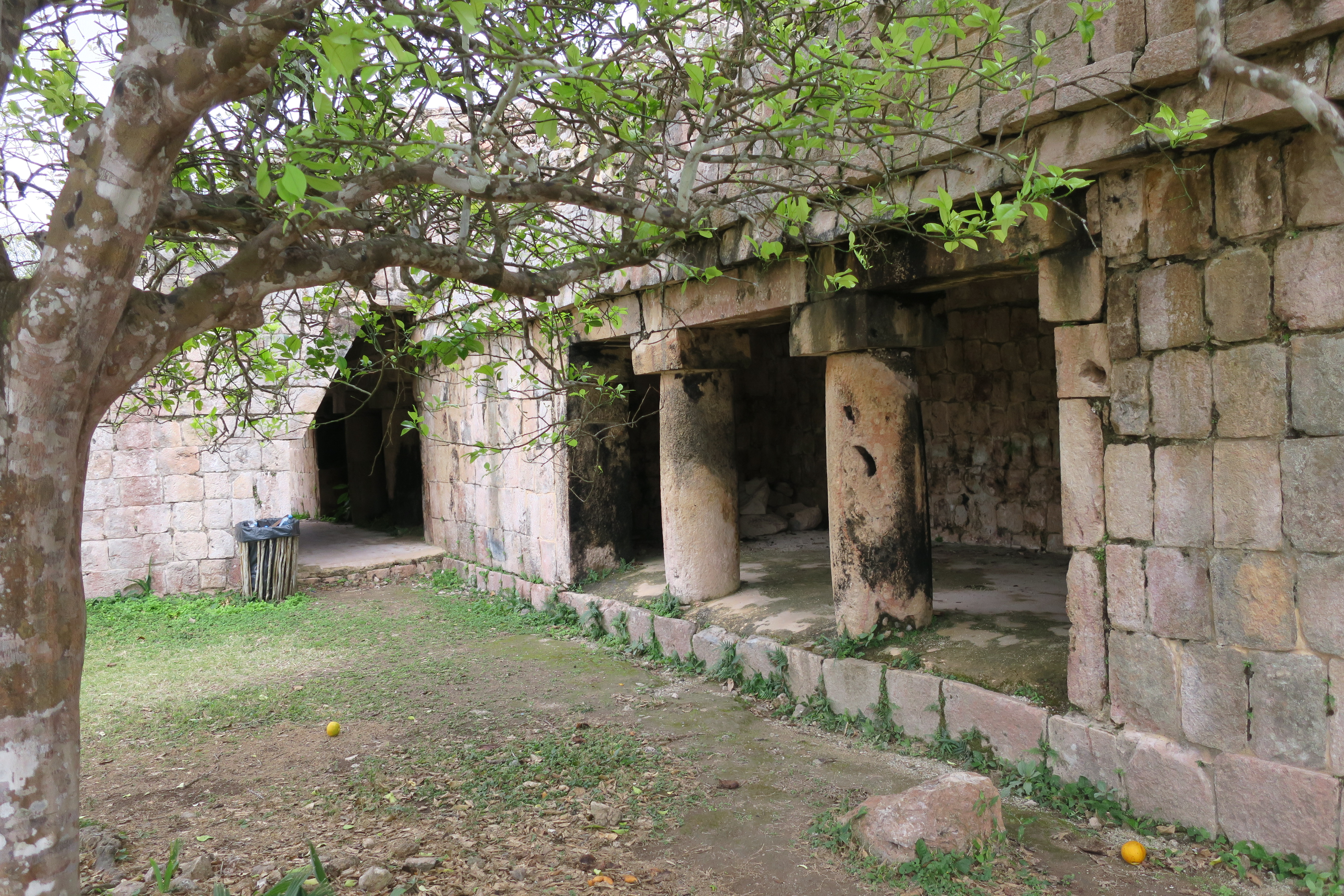
The Lower Square.
When we enter, the east side of the Lower Square is in front of us (top
photo, behind the sleeping dog) and the south side of the square is on
our right (bottom photo).
|
|
Towards the Palace of the Masks.
Climbing the stairs towards the Palace of the Masks.
|
|
The Palace of the Masks.
The most famous structure at Kabah is the "Palace of the Masks" (El Palacio de los Mascarones), the façade decorated with hundreds of stone masks of the long-nosed
rain god Chaac; it is also known as the Codz Poop, meaning "Rolled
Matting", from the pattern of the stone mosaics.
-
Undoubtedly, during the years 750-950 AD, no Kabah construction
competed with the Codz Pop, a 26-room building that occupies the
central place in the Lower Square. Its hierarchy is reinforced by its
height and by the huge three-level crest that crowns it.
-
The construction underwent important changes throughout its history.
Archaeologists calculate that at first 358 masks of the long-nosed god
adorned its four sides.
|
|
Masks of the rain god.
Masks of the rain god abound on other structures throughout the site.
Copal incense has been discovered in some of the stone noses of the
raingods.
-
The emphasis placed on Chaac, the Protector of the Harvest, both here
and at other neighboring Puuc sites, stemmed from the scarcity of
water in the region.
-
There are no cenotes in this dryer, northern part of the
Yucatán, so the Maya here had to depend solely on rain.
-
See more at
Chaac - Wikipedia.
|
|
Illustration of the city of Kabah.
In the foreground is the reconstruction of the Palace of the Masks. In
the background to the left is the Palace.
|
|
North side of the Palace of Masks.
|
|
East side of the Palace of Masks.
Later, a row of rooms was built on the east side that covered the
previous façade.
-
The central decoration was a frieze with seven figures of the King of
Kabah, who is distinguished by having scarifications on his face.
-
This same ruler is represented on the jambs of rooms 1 and 21; in the
latter the celebration of a victory is narrated.
|
|
West staircase of the Teocalli.
|
|
Teocalli wall.
We pass from the Palace of the Masks to the main Palace, walking along
the west wall of the Teocalli.
|
|
North facade of the Teocalli.
Limiting the south side of the Palace Square is the Teocalli, a
two-story building with 36 vaulted rooms, 20 on the ground floor and 16
on the upper floor. Its main façade is oriented towards the Palace
Square.
-
It was decorated with modeled and painted stucco, although the
excavations only found the spikes and pedestals that served to support
different figures.
-
It has two flown staircases, one on the north side and the other on
the west; the latter allowed its inhabitants to go to the Lower Square
quickly.
|
|
The Palace and Palace Square.
We arrive at the Palace (center) and Palace Square (left). The Teocalli
is on the right side.
|
|
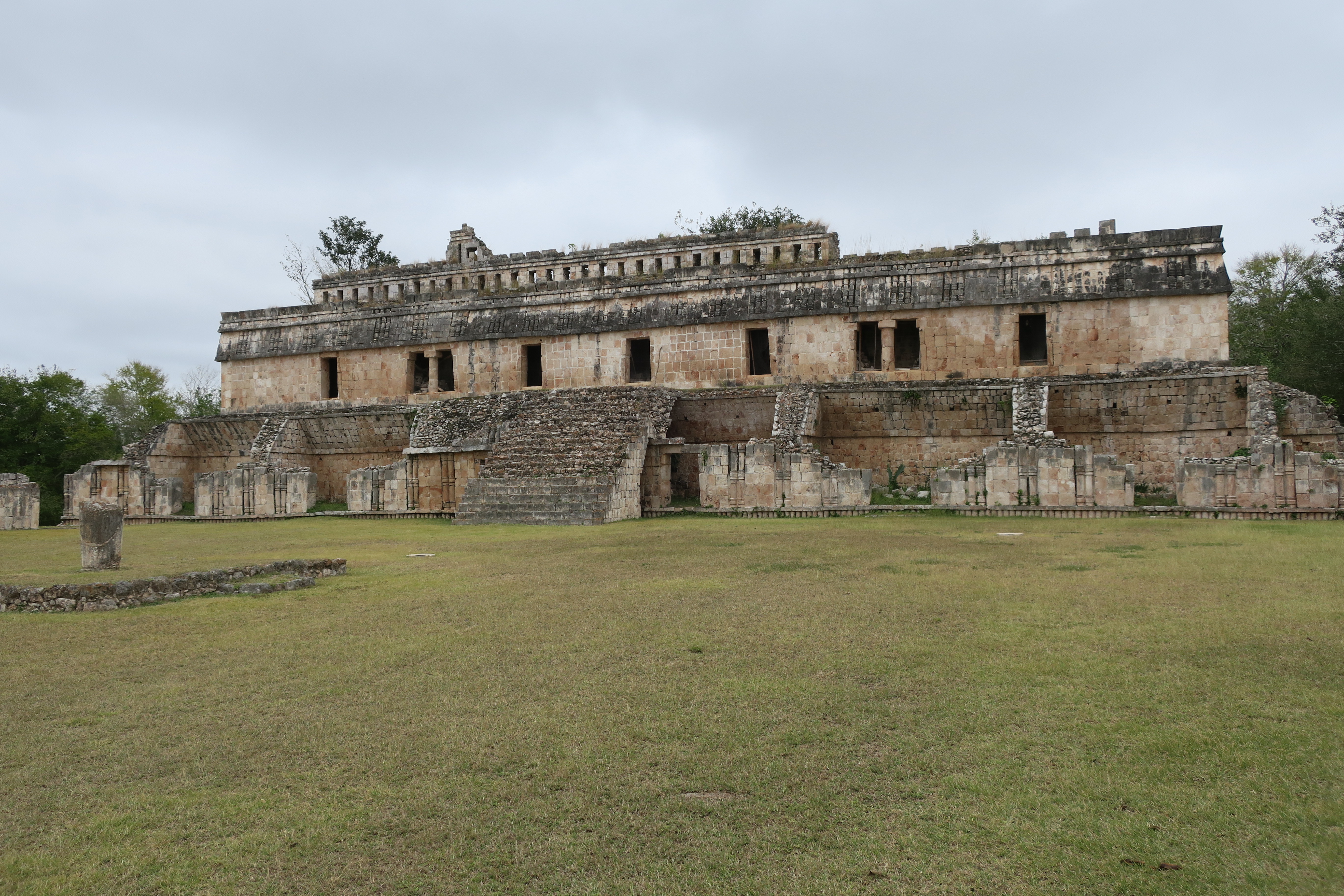
The Palace.
The Palace is a two-story structure and looms large in the Palace
Square.
-
The Palace has 32 vaulted rooms, 16 on the first floor and as many on
the second.
-
Its decoration is austere, since unlike other Puuc buildings, the
frieze only has sets of columns alternated with smooth panels.
-
Its hierarchy is reinforced by an openwork crest that crowns it and
allows it to be appreciated from afar.
-
The central axis of the building is marked by cantilevered stairways
that are located on the east and west fronts and emphasize its
symmetrical arrangement.
|
|
Descending from the Palace Square to the Lower Square.
|
|
In the Lower Square towards the exit.
|
See also
Source
Location