Tikal (Tik’al in modern Mayan orthography) is the ruin of an ancient city,
which was likely to have been called Yax Mutal, found in a rainforest in
Guatemala. It is one of the largest archeological sites and urban centers of
the pre-Columbian Maya civilization. It is located in the archeological region
of the Petén Basin in what is now northern Guatemala. Situated in the
department of El Petén, the site is part of Guatemala's Tikal National Park
and in 1979 it was declared a UNESCO World Heritage Site.
Tikal was the capital of a conquest state that became one of the most powerful
kingdoms of the ancient Maya. Though monumental architecture at the site dates
back as far as the 4th century BC, Tikal reached its apogee during the Classic
Period, c. 200 to 900. During this time, the city dominated much of the Maya
region politically, economically, and militarily, while interacting with areas
throughout Mesoamerica such as the great metropolis of Teotihuacan in the
distant Valley of Mexico. There is evidence that Tikal was conquered by
Teotihuacan in the 4th century AD. Following the end of the Late Classic
Period, no new major monuments were built at Tikal and there is evidence that
elite palaces were burned. These events were coupled with a gradual population
decline, culminating with the site's abandonment by the end of the 10th
century.
Tikal is the best understood of any of the large lowland Maya cities, with a
long dynastic ruler list, the discovery of the tombs of many of the rulers on
this list and the investigation of their monuments, temples and palaces.
|
Tikal reconstruction model.
|
|
Tikal map.
On this map north is at the top and south is at the bottom. The route
taken is marked with red arrows.
|
|
Ceiba tree.
A local botanist teaches us about the importance of the ceiba tree to
the Mayas.
-
Ceiba is a genus of trees in the family Malvaceae, native to tropical
and subtropical areas of the Americas (from Mexico and the Caribbean
to N Argentina) and tropical West Africa. Some species can grow to 70
m (230 ft) tall or more, with a straight, largely branchless trunk
that culminates in a huge, spreading canopy, and buttress roots that
can be taller than a grown person.
-
The Ceiba, or ya’axché (in the Mopan Mayan language),
symbolised to the Maya civilization an axis mundi which
connects the planes of the Underworld (Xibalba) and the sky
with that of the terrestrial realm. This concept of a central world
tree is often depicted as a Ceiba trunk.
-
The unmistakable thick conical thorns in clusters on the trunk were
reproduced by the southern lowland Maya of the Classical Period on
cylindrical ceramic burial urns or incense holders.
-
The Ceiba tree is represented by a cross and serves as an important
architectural motif in the Temple of the Cross Complex at Palenque.
-
See more at
Ceiba - Wikipedia.
|
|
Walking towards the Palace of the Vertical Columns.
|
|
Palace of the Vertical Columns.
Tikal Group G is located on the eastern edge of the ceremonial centre
and is accessed from the Mendez causeway that leads to Temple VI (the
Temple of Inscriptions). The extensive ruins of Tikal Group G are
thought to be the palace of one of Tikal’s foremost builders, King
Yik’in Chan K’awiil – the son of King Jasaw Chan K’awiil, whose funerary
monument and resting place is the iconic Temple 1 in the main plaza.
This would date the construction of Tikal Group G to around 734AD to
746AD.
-
Tikal Group G is also known as the Palace of the Vertical Columns (Palacio Acanaladuras) thanks to its design which features vertical column-like elements
known as pseudo-columns. These are visible along the façades of the
building, but are most apparent on the rear wall. The buildings are
extremely well executed, which is partly why they have been attributed
to Tikal’s master builder, King Yik’in K’awiil, who is also though to
be responsible for completing his father’s work on Temple I and Temple
II, as well as constructing the Maler and Mendez Causeways and
building Temple IV and Temple VI. One example of the architectural
mastery is the flamboyant use of corbel-vaulted passageways and
windows between the chambers and plazas.
-
Tikal Group G is very extensive and was clearly a place of prominence
during the Late Classic Period. Today, it is one of the largest groups
that has been uncovered, with a total of 29 vaulted chambers and the
remains of a second storey which also featured vaulted ceilings . To
add some intrigue to the findings, archaeologists also found the
remains of what was once a giant stucco monster mask of a character
known as the Witz Monster.
|
|
Towards Temple V.
Going through the jungle to reach Temple V.
|
|
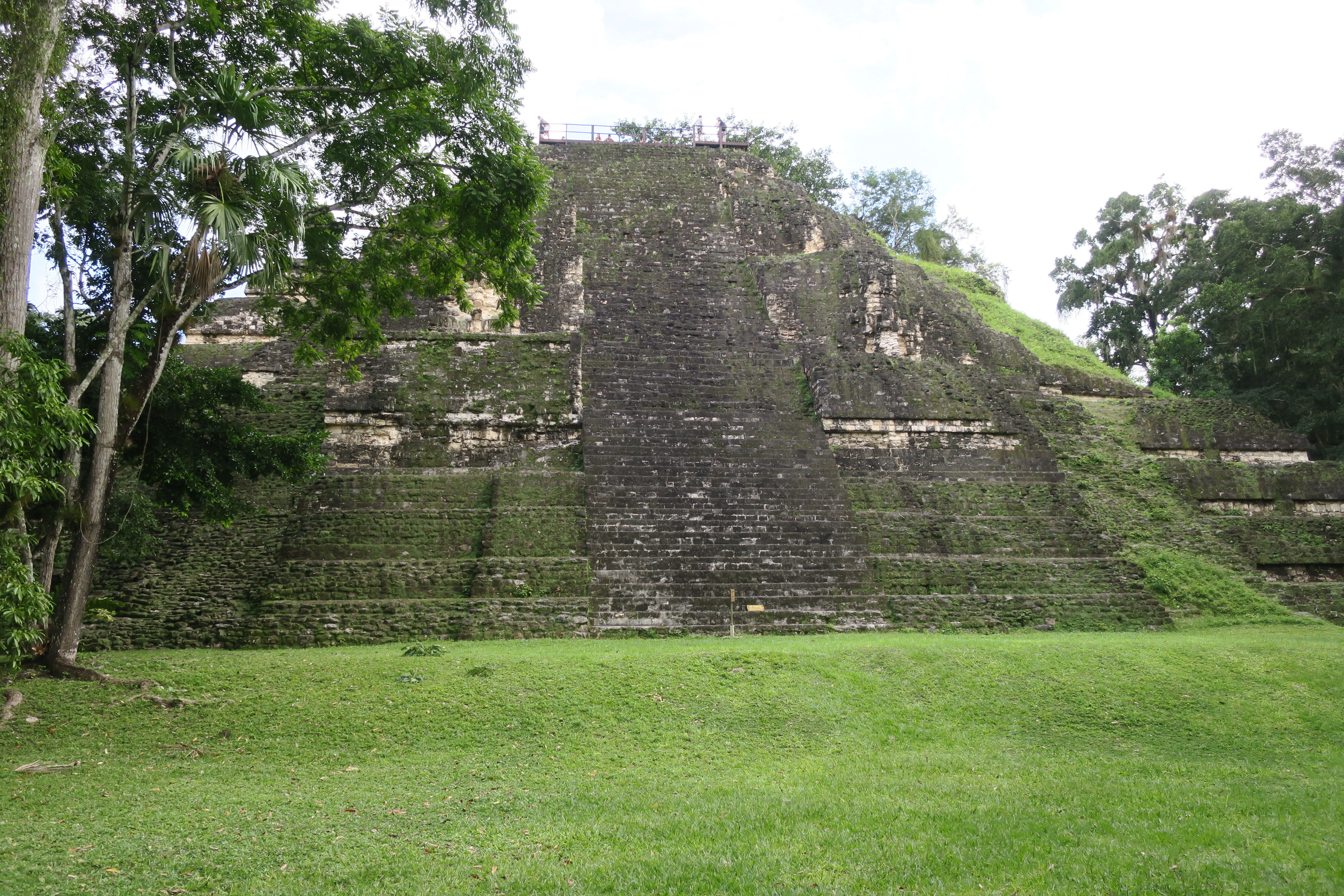
Temple V.
Temple V stands south of the Central Acropolis and is the mortuary
pyramid of an as yet unidentified ruler.
-
The temple stands 57 meters (187 ft) high, making it the second
tallest structure at Tikal – only Temple IV is taller.
-
The temple has been dated to about AD 700, in the Late Classic period,
via radiocarbon analysis and the dating of ceramics associated with
the structure places its construction during the reign of Nun Bak Chak
in the second half of the 7th century.
-
See more at
Tikal Temple V - Wikipedia.
|
|
Restoration of the Temple V.
Passing beside Temple V towards the South Acropolis.
|
|
The South Acropolis and the Square of the Seven Temples.
The South Acropolis is found next to Temple V. It was built upon a large
basal platform that covers an area of more than 20,000 square meters
(220,000 sq ft). The Square of the Seven Temples is to the west of the
South Acropolis. It is bordered on the east side by a row of nearly
identical temples, by palaces on the south and west sides and by an
unusual triple ballcourt on the north side.
|
|
On the way to the Lost World.
|
|
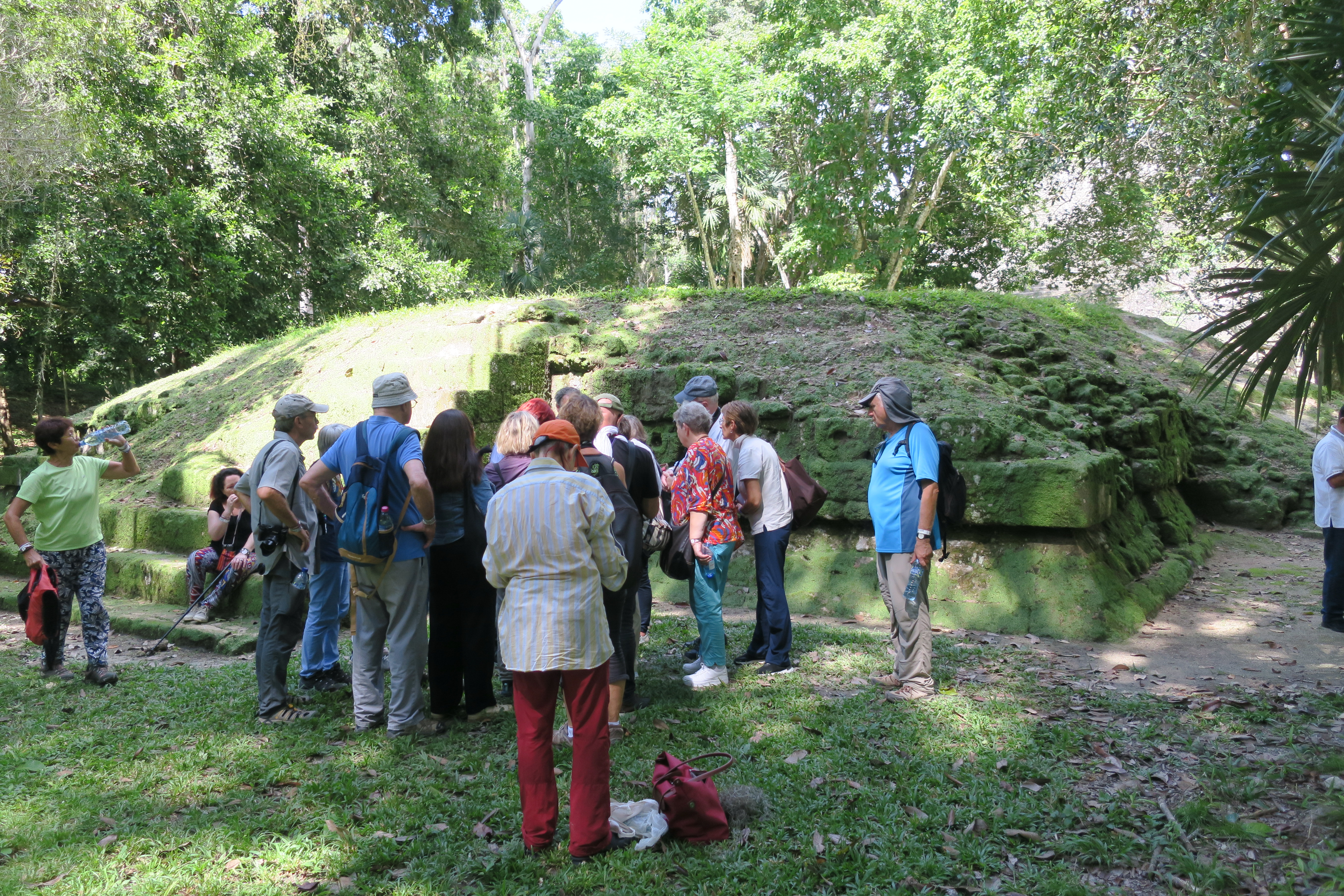
The Lost World.
The Lost World (Mundo Perdido) is to the west of the Square of
the Seven Temples. It is the largest ceremonial complex dating from the
Preclassic period at Tikal.
-
The complex was organized as a large E-Group consisting of a pyramid
aligned with a platform to the east that supported three temples.
-
The Lost World complex was rebuilt many times over the course of its
history.
-
By AD 250–300 its architectural style was influenced by the great
metropolis of Teotihuacan in the Valley of Mexico, including the use
of the talud-tablero form.
-
During the Early Classic period (c. 250–600) the Lost World became one
of the twin foci of the city, the other being the North Acropolis.
- From AD 250 to 378 it may have served as the royal necropolis.
-
The Lost World complex was given its name by the archeologists of the
University of Pennsylvania; it is centered upon the Lost World Pyramid
and a small platform to the west of it.
-
To the south of Lost World, recent 2021 excavations have revealed a
one-third size replication of La Ciudadela, or The Citadel, in
Teotihuacan. This area may have been used as a diplomatic headquarters
and as an effort to further stamp Teotihuacan culture upon the
residents of Tikal.
|
|
On the way to the Temple IV.
|
|
Climbing to the top of Temple IV.
|
|
Temple IV.
Temple IV is the tallest temple-pyramid at Tikal, measuring 70 meters
(230 ft) from the plaza floor level to the top of its roof comb.
-
Temple IV marks the reign of Yik’in Chan Kawil (Ruler B, the son of
Ruler A or Jasaw Chan K'awiil I) and two carved wooden lintels over
the doorway that leads into the temple on the pyramid's summit record
a long count date (9.15.10.0.0) that corresponds to CE 741.
-
Temple IV is the largest pyramid built anywhere in the Maya region in
the 8th century, and as it currently stands is the tallest
pre-Columbian structure in the Americas although the Pyramid of the
Sun at Teotihuacan may originally have been taller, as may have been
one of the structures at El Mirador.
-
See more at
Tikal Temple IV - Wikipedia.
|
|
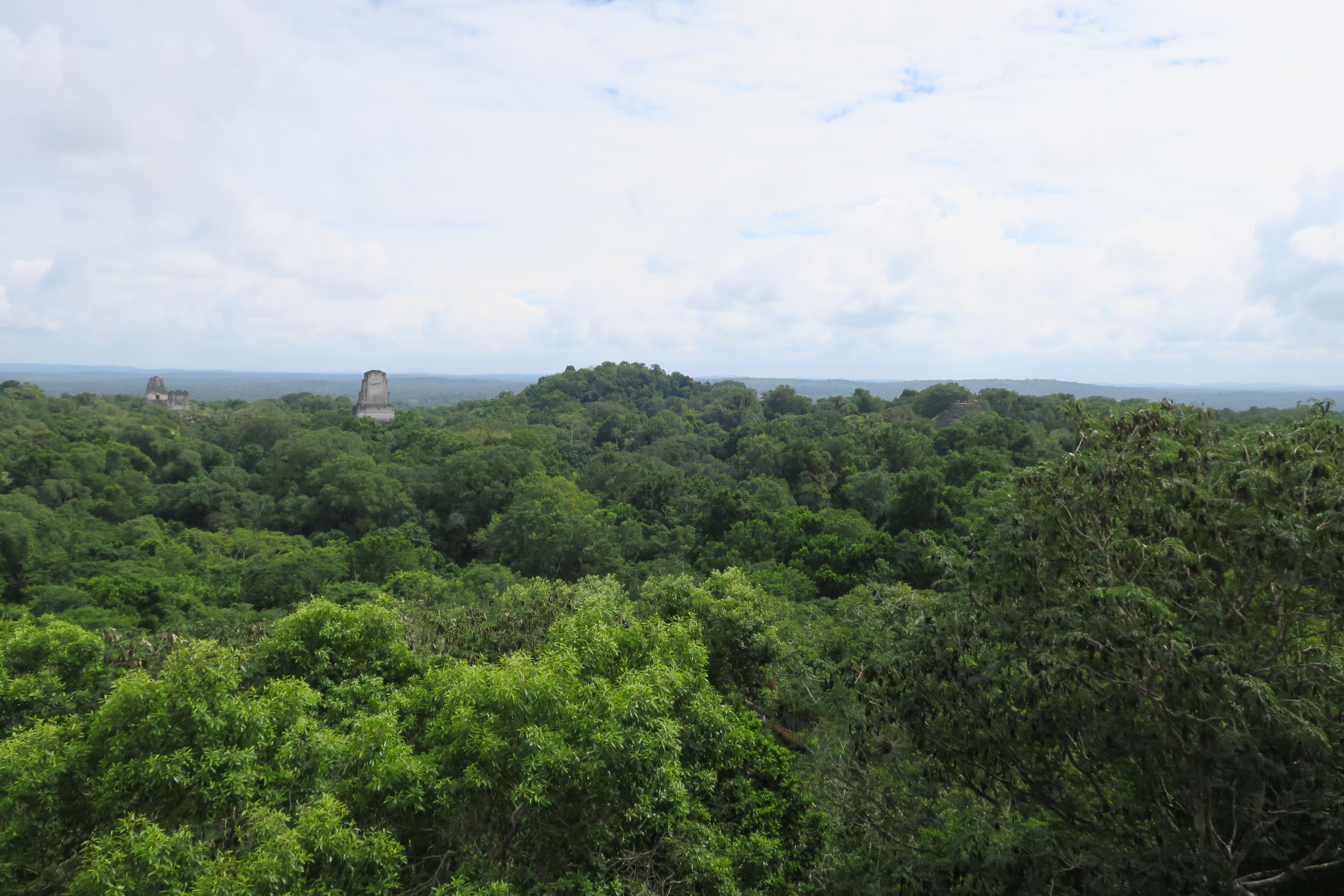
Panoramic view of Tikal.
Panoramic view of Tikal from the top of Temple IV towards the southwest.
|
|
Descending from Temple IV.
A South American coati crosses our path.
|
|
Walking towards Temple II.
|
|
South American coatis.
The South American coati (Nasua nasua), also known as the
ring-tailed coati, is a coati species and a member of the raccoon family
(Procyonidae), found in the tropical and subtropical parts of
South America.
-
An adult generally weighs from 2–7.2 kg (4.4–15.9 lb) and is 85–113 cm
(33–44 in) long, with half of that being its tail.
-
Its color is highly variable and the rings on the tail may be only
somewhat visible, but its most distinguishing characteristic is that
it lacks the largely white snout (or "nose") of its northern relative,
the white-nosed coati.
-
See more at
South American coati - Wikipedia.
|
|
Temple II.
Temple II (also known as the Temple of the Mask) it was built around AD
700 and stands 38 meters (125 ft) high.
-
Like other major temples at Tikal, the summit shrine had three
consecutive chambers with the doorways spanned by wooden lintels, only
the middle of which was carved.
-
The temple was dedicated to the wife of Jasaw Chan K'awil, although no
tomb was found.
-
The queen's portrait was carved into the lintel spanning the doorway
of the summit shrine.
-
See more at
Tikal Temple II - Wikipedia.
|
|
The Great Square.
The Great Square lies at the core of the site; it is flanked on the east
and west sides by two great temple-pyramids.
-
On the north side it is bordered by the North Acropolis and on the
south by the Central Acropolis.
|
|
Temple II seen from the Great Square.
|
|
Temple I.
Temple I (also known as the Temple of Ah Cacao or Temple of the Great
Jaguar) is a funerary pyramid dedicated to Jasaw Chan K'awil, who was
entombed in the structure in AD 734, the pyramid was completed around
740–750. The temple rises 47 meters (154 ft) high.
-
The massive roofcomb that topped the temple was originally decorated
with a giant sculpture of the enthroned king, although little of this
decoration survives.
-
The tomb of the king was discovered in 1962. Among items recovered
from the Late Classic tomb were a large collection of inscribed human
and animal bone tubes and strips with sophisticated scenes depicting
deities and people, finely carved and rubbed with vermilion, as well
as jade and shell ornaments and ceramic vessels filled with offerings
of food and drink.
-
The shrine at the summit of the pyramid has three chambers, each
behind the next, with the doorways spanned by wooden lintels fashioned
from multiple beams.
-
See more at
Tikal Temple I - Wikipedia.
|
|
North Acropolis.
The North Acropolis, together with the Great Plaza immediately to the
south, is one of the most studied architectural groups in the Maya area;
the Tikal Project excavated a massive trench across the complex,
thoroughly investigating its construction history.
-
It is a complex group with construction beginning in the Preclassic
Period, around 350 BC.
-
It developed into a funerary complex for the ruling dynasty of the
Classic Period, with each additional royal burial adding new temples
on top of the older structures.
-
After AD 400 a row of tall pyramids was added to the earlier Northern
Platform, which measured 100 by 80 meters (330 by 260 ft), gradually
hiding it from view.
-
Eight temple pyramids were built in the 6th century AD, each of them
had an elaborate roofcomb and a stairway flanked by masks of the gods.
-
By the 9th century AD, 43 stelae and 30 altars had been erected in the
North Acropolis; 18 of these monuments were carved with hieroglyphic
texts and royal portraits.
-
The North Acropolis continued to receive burials into the Postclassic
Period.
-
See more at
North Acropolis, Tikal - Wikipedia.
|
|
The Great Square seen from the North Acropolis.
|
|
Temple II seen from the North Acropolis.
|
|
Temple I seen from the North Acropolis.
|
|
Leaving the Great Square.
Leaving the Great Square through the southeast towards the Great Plaza
Ballcourt.
|
|
The Great Plaza Ballcourt.
The Great Plaza Ballcourt is a small ballcourt that lies between Temple
I and the Central Acropolis.
|
|
The Maler Causeway.
The Maler Causeway runs north from behind Temple I to Group H.
|
|
Temple I seen from behind.
|
|
Ocellated turkey.
The ocellated turkey (Meleagris ocellata) is a species of turkey
residing primarily in the Yucatán Peninsula, Mexico, as well as in parts
of Belize and Guatemala.
-
The ocellated turkey lives only in a 130,000 km2 (50,000 sq mi) range
in the Yucatán Peninsula in Mexico—which includes all or part the
states of Quintana Roo, Campeche, Yucatán, Tabasco, and Chiapas—as
well as the northern and western parts of Belize and northern
Guatemala.
-
See more at
Ocellated turkey - Wikipedia.
|
|
Group R.
Group R is a twin-pyramid complex, dated to 790. It is close to the
Maler Causeway.
|
|
Howler monkey.
Howler monkeys (genus Alouatta, monotypic in subfamily Alouattinae) are
the most widespread primate genus in the Neotropics and are among the
largest of the platyrrhines along with the muriquis (Brachyteles), the
spider monkeys (Ateles) and woolly monkeys (Lagotrix).
- The monkeys are native to South and Central American forests.
-
They are famous for their loud howls, which can travel more than a
mile through dense rain forest.
-
See more at
Howler monkey - Wikipedia.
|
|
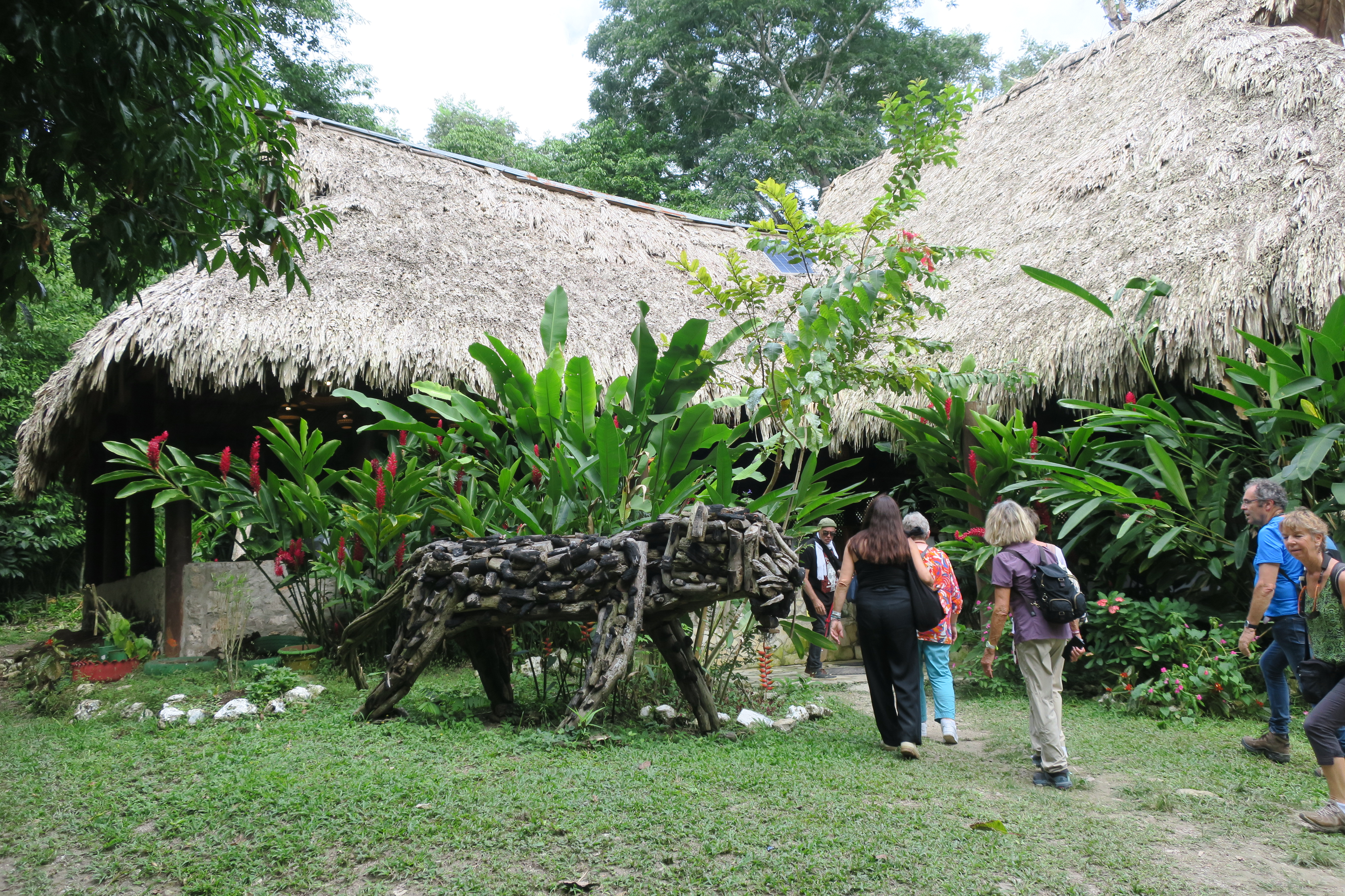
Crossing the jungle.
Walking through the jungle towards the restaurant.
|
|
Collared peccary.
The collared peccary (Dicotyles tajacu) is a species of
artiodactyl (even-toed) mammal in the family Tayassuidae found in North,
Central, and South America.
-
They are commonly referred to as javelina, saíno, or
báquiro, although these terms are also used to describe other
species in the family. The species is also known as the
musk hog.
|
|
Tikal Museums.
There are two museums inside the Tikal National Park; the Stelae museum
and the Sylvannus G. Morley Museum.
-
The Stelae Museum was a project to rescue important stelae from
the natural elements. You'll also find there a reproduction of one of
Tikal's most famous images, the bound captive. A powerful warrior,
standing, seen in profile, he looks down with chagrin to his bound
wrists.
-
The Sylvannus G. Morley Museum is situated to your left as you
face the entrance to the site. Here you will be able to find a
reconstruction of the tomb and burial goods of Ha Sawa Chaan K’awil
one of the great builders of Tikal. Replica of the jade found in the
tomb can also be seen here (the original can be found in the National
Museum, Guatemala City)
|
|
Sunset over Lake Petén Itza.
Sunset over Lake Petén Itza from the balcony of the Camino Real Tikal
Hotel.
|
Source
Location