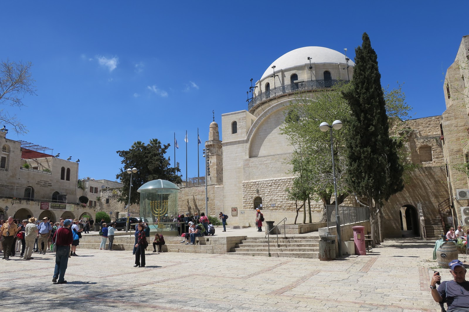
The Jewish Quarter is one of the four traditional quarters of the Old City of
Jerusalem (part of Israeli-occupied East Jerusalem).
The 116,000 square meter area lies in the southeastern sector of the walled
city, and stretches from the Zion Gate in the south, along the Armenian
Quarter on the west, up to the Street of the Chain in the north and extends to
the Western Wall and the Temple Mount in the east. In the early 20th century,
the Jewish population of the quarter reached 19,000.
The quarter is inhabited by around 2,000 residents and is home to numerous
yeshivas and synagogues, most notably the Hurva Synagogue, destroyed
numerous times and rededicated in 2010.
|
Western Wall Plaza.
The area lies in the southwestern sector of the walled city, and
stretches from the Zion Gate in the south, along the Armenian Quarter on
the west, up to the Street of the Chain in the north and extends to the
Western Wall and the Temple Mount in the east.
-
The new plaza created in 1967 is used for worship and public
gatherings, including Bar mitzvah celebrations and the swearing-in
ceremonies of newly full-fledged soldiers in the Israel Defense
Forces.
-
In November 2010, the government approved a NIS 85m ($23m) scheme to
improve access from the Jewish Quarter and upgrade infrastructure at
the Wall.
-
See more at
Western Wall, Plaza - Wikipedia.
|
|
Hurva Synagogue.
Hurva Synagogue (English: Ruined Synagogue) is the currently largest
synagogue in the Jewish Quarter.
-
It was originally intended for construction in the 18th century. A
small building was constructed, but due to financial difficulties, the
intended larger building was not completed.
-
The building was destroyed by an earthquake, and a second attempt to
build a large synagogue was blocked by Arab landowners in the early
19th century failed.
-
In the 1860s, the large synagogue was completed. It was destroyed by
the Jordanians following the 1948 Israeli War of Independence.
-
The synagogue was rebuilt in 2009 and is a distinguished feature of
Jerusalem's Old City skyline.
-
See more at
Hurva Synagogue - Wikipedia.
|
|
Ramban Synagogue.
The Ramban Synagogue is the second oldest active synagogue in the Old
City of Jerusalem.
-
It was founded by the scholar and rabbi Nachmanides (also known as
Ramban) in 1267, to serve the local Jewish community, which expanded
because of the synagogue's presence.
-
See more at
Ramban Synagogue - Wikipedia.
|
|
Ramban Synagogue.
After the Disputation of Barcelona, Nachmanides was exiled from Aragon,
and in 1267 he made aliyah to the Land of Israel.
-
In an alleged letter to his son, he described the Jewish community of
Jerusalem devastated by the Khwarezmian Tatars.
-
Seventy two years old, he undertook the effort to rebuild the Jewish
community and chose a ruined house on Mount Zion to reconstruct it as
a synagogue.
-
A number of Jews moved to Jerusalem after hearing of Nachmanides'
arrival.
-
The Torah scrolls that were evacuated to Shechem before the Mongol
invasion were returned. In three weeks, for Rosh Hashanah, the
synagogue was ready for use.
-
See more at
Nachmanides - Wikipedia.
|
|
Inside Ramban Synagogue.
Over the years, the building has been the home to the Sephardi
community, was converted into a mosque after being confiscated by a
Mufti, and was used as a flour mill and a cheese factory. Today it is
used by the Ashkenazi community.
-
The western entrance opens up to the Jewish Quarter Road and leads
through the study hall (beit midrash) to the main room, while
the southern entrance can be reached from a staircase leading down
from the Hurva Synagogue.
-
The synagogue's prayer hall has an elongated and slightly trapeze-like
shape (21.5 m by 6.7-7.3 m). Four columns, all in secondary use and
with unadorned square capitals, are splitting the hall into two isles.
The fifth one was removed and placed outside the southern entrance, in
order to create space for the bimah, which takes a central
position but never stood under a dome. The western end of the prayer
hall has been extended in order to allow for a women's section, while
the other, eastern end holds the Torah arks, one at the end of each
isle.
|
|
Roman Cardo.
The main north–south thoroughfare, the Cardo Maximus, was originally a
paved avenue approximately 22.5 meters wide (roughly the width of a six
lane highway) which ran southward from the site of the Damascus Gate,
terminating at an unknown point. The southern addition to the Cardo,
constructed under Justinian in the 6th century AD, extended the road
further south to connect the Church of the Holy Sepulchre with the newly
built Zion Gate.
-
Along its length, the roadway was divided into three parts: two
colonnaded covered walks flanking a 12 meter wide road.
-
The shaded porticoes provided separation of pedestrian traffic from
wheeled carts, shelter from the elements, space for small-scale
commerce, as well as opportunities for residents and visitors to
gather and interact.
-
The central open pavement provided commercial access as well as ritual
space. The Cardo's most striking visual feature was its Colonnade,
clearly depicted on the Madaba Map.
-
See more at
Cardo, Jerusalem - Wikipedia.
|
|
Street theater in the Jewish Quarter.
|
See also
Source
Location